Day 9. Thursday 22 June. Still “nowhere”. Towards Kiska/Adak.
0730 440 38.824 N 162 0 13.747E. Log (0/878)nm. Wind still 30kn. Lying-a-hull. 6 hours sleep/rest. Weather downloaded. Coffee and breakfast. Quite comfortable on the floor. GRIB shows low is now centred NE of us and where we are it is only 15-20kn of wind apparently. Look out the window. Nope, howling still.
0830 Moving again. Wind 25kn West. COG 50T. SOG 7kn. M3 and Staysail.
1230 COG 50T SOG 6.5kn. Log (25)nm. Wind west 20kn.
1830 COG 50T SOG 7.5. Log 63nm. Wind W15kn sea 2m. Sky clear, Baro 1016. An area of high pressure moving in quickly. Low has finally taken off east at speed. Good riddance. M1 G1. Will keep this sail area until Karen on duty. Making good time. 690Nm to Kiska, well within economical motoring range.
2300 COG 50T SOG 6kn. Log 91nm. M2 G2. Steady night. Very dark. No stars. Very cold. Karen on watch.
0300. Wind gone. Motor on.
0500. COG 50T SOG 5.5. Log 121nm. Motoring/M2. Wind W 10kn true. A good days run, sea now flat and wind light. Karen off watch as very very cold.
0600 Sails up. Motor off. COG 50T. Speed 4kn.
0830 COG 50T. SOG 5.5kn. Log (137/1015)nm. Motoring 1500RPM. Main only. Wind <10kn W.
Days Run 137nm. All DMG. Marvellous what a difference a day makes. Fuel consumption about 25L. Fuel level (actual) 380L + 140 reserve. Our economy at 1500 RPM with heater on continuous is about 2.4L/h.
Day 10. Friday 23 June 2023. From: Somewhere. Towards: Adak/Kiska.
0830 COG 50T. SOG 5.5. Log (0/1015)nm. Baro 1014. High pressure system. Sea 1m Motoring.
1030 Motoring 5kn. No wind today. Tried poled Genoa etc etc. No benefit and sails just slat. Dropped all sails. GRIB suggests NW wind tonight.
1700 COG 60T SOG 5.2. Motoring. Log (42)nm. Kiska 560nm. Option for Kiska is to motor at 6.2kn average SOG, arrive Tuesday evening. Alternative, direct to Adak. 772Nmn Arrive Thursday arvo. If needed potential stop mid way at Constantine Harbour 620nm. Kiska 4 days, Constantine 4.5 days, Adak 5.5. days. Will steer middle ground and decide based on Monday morning weather forecast. Ross says Strong Wind coming from NW Wednesday.
2100 Sailing!!! COG 55T. SOG 6kn. Log (68)nm. Wind WNW 11kn. M1 G1.
2330 High Water alarm. Definitely leaking more sea water, under galley floor and starboard engine room bilge. Water ingress traced to exhaust thru hull, which is currently deeply buried on port tack. Karen on watch. Dried and cleaned area with acetone. Thru Hull looks intact, water seeping but not gushing between lock nut and hull. Could be cracked/corroded or could just be the sealant. Bogged with underwater epoxy filler. Extra hose clamps gently added just in case it’s the hose. Rate is now about 1L in 2 hours so minimal. Bronze fitting, so don’t want to mess with it. Dean to bed 0200.
0600 Karen off watch, as a Popsicle
0700 Good boat speed. SOG 6.7kn
0830 COG 50T. SOG 6.8kn. Log (129/1144)nm. Full Main G1. Wind W 13kn. Sea 1m. 100% cloud. Clear. I expect this wind to last until tonight. Will then motor at 6kn until Sunday when more wind expected. ETA Kiska Tuesday arvo. That is closest anchorage to fix our leak, then ADAK to refuel once next low passes on Thursday.
Days Run. 129nm. All DMG. 12 hours sailing 12 hours motoring. Estimate fuel usage 30L.
Day 11. Saturday 24 June 2023. 480nm SW of Kiska. Towards Kiska.
0830 47 0 21.06N 167 0 13.60 E . Log (0/1144)nm. Good wind. Full Main. Genoa 1.
1130 COG 50T. SOG 7.0kn/ Log (21)nm. M1 G1. Wind W20kn. Sea 1m. Baro 1011. Cloud 100%. Vis Clear. Fog patches Wind now gusting 20kn so reef back in main. SOG stays same. Well ahead of time as only need to average 6kn. Ayametta is 93nm SW and worried about strong wind arriving on 28th. They are day behind us so will probably not make Kiska before it.
1400. Fog and cloud cleared!
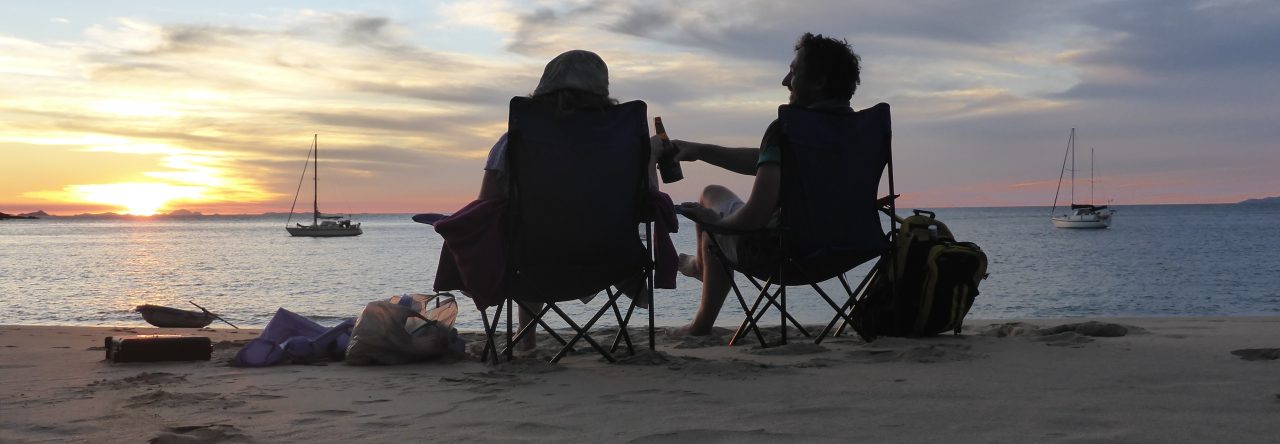
1830. An actual sunset!
1930 COG 55T. SOG 7kn. Log (74)nm. M1 G1. Wind W 19. Sea 1m. Cloud 20%. Stars out. First clear day and night in weeks! There are dark clouds to the NW. So far today our average speed in 6.7kn.
2359 Dean off watch. COG 55T. SOG 6.3. Log (103)nm. Sea rolly about 1.5m. Wind W 19. Poled Genoa 1 reef only. No banging mainsail. Colder as clear skys. Baro 1008.
0600 Karen off watch. COG 60T. SOG 5.5. Log (136)nm. Wind WNW 12. Sea 1m. Cloud 50% Clear. Running engine for batteries but also to increase SOG. CAR (charge acceptance rate) is down, cold.
0730 (UTC+10) 0830 (UTC+11). Changed ships time to UTC +11. Log (144/1288)nm.
Days Run 144nm in 23 hours. Good that’s a 150nm day!! Kiska landfall is likely midday Tuesday 330nm at 6.4kn. Minimal fuel usage about 15L.
Day 12. Sunday 25 June 2-23. UTC +11. Towards Kiska.
0830 48 0 45.90N 170 0 06.33E . Log (0/1288)nm. Expect a steady west wind today, then calm tonight. Fuel 305L actual plus 120L reserve. At 2000 RPM 5L/H. 250L will give 50Hours motoring at 6+ kn.
2015 COG 52T. SOG 6.2kn. Log (74)nm. Motor sailing. Wind W 8kn. Fog is back.
0015 Karen on watch. COG 50T. SOG 6.1kn. Log (98)nm. Wind W 10. Rain showers. Very very cold. Tarped foot well of cockpit to keep rain out and feet dry.
0530 Dean on watch. COG 60T Motoring. SOG 6kn.
0830 COG 60T SOG 6.1kn. Log (147/1435)nm
Days Run. Another 150nm run. Fuel usage 55L in 22Hr at 1800RPM. Water leak is minimal if boat not heeling.
Day 13. Monday 26 June 2023. UTC +11. 1 day to Kiska!
0830 50 0 07.36N 172 0 51.32 E. Log (0/1435)nm. Clear weather expected but no wind. Ross advises counter current about 1kn.
1230 COG 60T. SOG 5.7kn. Log (23)nm. A clear day but 100% cloud. Calm sea. ETA remains early afternoon tomorrow despite current. Wind now slightly north. This is probably the beginning of the NW change that should become W 25-30kn on Wednesday.
1830 COG 56T. SOG 6.2kn. Log (67)nm. Ayametta has turned SE, I assume setting course for ADAK going under the coming gale as will not reach KISKA before it. Wise.
2359 Karen on watch. COG 59T SOG 6.0kn. Log (98)nm. Sailing last 3 hours. But motor back on as wind dropped.
0600 Dean on watch. COG 60T. SOG 6.2kn. Log (138/1573)nm.
Days Run. 138 nm in 22 Hr so another 150nm day.
Day 14. Tuesday 27 June 2023. Towards Kiska.
0600 51 0 25.86 N 176 0 08.55E. Log (0/1573)nm. A clear day dawning! 50Nm to landfall, 65nm to South Pass and 70nm to Kiska harbour. Aiming for South pass slack tide 1512. Peak flood 2.3kn at 2050.
0900 COG 68T. SOG 5.9kn. Log (17)nm. Have a west setting current. Large pod of dolphins to welcome us.
1355 COG 050T.SOG 6kn. Log 50nm. Kiska arrival 2nm S of Sobaka Rock. 2 hours before ETA. Hailed by RV Taglax, a fisheries research vessel. Captain Farris. He has been watching our progress on AIS and was expecting us!! “Are you still making for Kiska Harbour?” and “How is your Water ingress problem?” Bizarre! Clearly Ross has been talking. Thanks Ross and Captain Farris for watching over us and Local Knowledge: “Kiska Harbour is the best harbour out here” “Keep well west in South passage” “Constantine is also excellent in west weather if you need to stop on the way to ADAK”.
1500 Nice putter across KISKA’s south coast. Sun out. No wind.
1530 South Pass. Kept west. Wind 20kn NW on exiting. Squalls and massive temperature drop. Amazing land effect. This wind is off the snow capped volcano we can not see as in cloud.
1700 (JST 1500). Anchor down and holding. Wind gusting 25kn NW. 11M depth. 60m scope. Kiska harbour 0.1nm south of ruined jetty, east of rocky headland. 1st attempt was closer in under headland outside kelp bed in 7m, felt like rock. 2nd attempt a bit further out wouldn’t dig in. 3rd attempt very firm grab. I am suspicious we have snagged something as there is a lot of wreckage here from the war. Won’t be budging tonight! So a problem for another day. Many white caps but no fetch or swell.
(addenda: Kiska Harbour has a reputation for amplifying Westerly winds as they funnel through the East West mountain valley at the head of the harbour. It can also get Katabatic winds from NW that blow down off its giant volcano in a north wester. When the Westerly strong winds arrived on Wednesday it was blowing 25kn at sea (on the GRIBS) on the west coast but in “sheltered” Kiska harbour it was gusting 35kn. The difference is no waves!! When we left it was still blowing 20kn, in the harbour and 5 miles east of Kiska it dropped to under 10kn once away from the land. Weird. And still a very safe protected harbour. Glad we came!)
Days run: Log (69/1642)nm.
Passage Summary
I consider Kiska our arrival point in Alaska and thus the end of the passage even though we still have to clear in at Dutch Harbour where CBP is expecting us. CBP was notified of our arrival in KISKA via email. I will include ADAK and DUTCH Harbour in a subsequent cruising note.
This passage was expected to be our hardest yet. And it was our hardest yet. And at the same time about as good as the weather ever gets in this part of the far North Pacific. I’ve read so many logs of folks who had it much worse. And, we will not ever do it again!! If we go to Japan again we will go back to Oz the same way we came. If we go to Alaska again we will go via Hawaii to Kodiak, which was our COVID plan if Japan and FSM stayed closed this year.
I expected 1-2 storms or gales and got 1 storm, which we mainly managed to dodge, and snuck into KISKA 10 hours before the next gale arrived. The Bering Sea fishermen have been unanimous in telling us this is a “shit summer” for weather, so I feel lucky.
Arrival Port – Kiska Harbour. Formal Entry Port will be Dutch Harbour.
Passage Distance Planned – 1500nm (Great circle route). Route abandoned due to storm avoidance.
Passage actual – 1642nm (A storm avoiding easterly meander on day 4-8).
Passage time planned – Kiska 11 days + 2 for weather
Passage time actual 13 days 7 Hours.
Stopped / Hove to: 14hours becalmed + 9 Hours for timing of storm avoidance + 6 hours actual gale. 29 hours total.
Average SOG excluding stopped. 5.6kn
Fuel usage 435L. 3.6l/Hr. Increased consumption due to motoring at 6kn @1800RPM. To get into Kiska on time.
Thoughts on the Passage
Weather forecasting. The MSLP’s (weather charts from JMA and NOAA) and GMDSS High Seas forecast (Text forecasts) are compiled by human meteorologists and were much more accurate than PW computer derived GRIBS and more timely in accurate updates. The MSLP labelling of “Developing Gale”, “Gale”, “Developing Storm” is non ambiguous, and charts in in old fashioned black and white format were much more meaningful than various shades of swirling orange and red on a GRIB. The GRIBS did catch up a day late and then showed the dreaded “black wind” and an obvious calm eye!! Scary.
A 24 hr GRIB was then quite good for showing me the likely usable wind bands and sailable conditions. Better than the large scale MSLP. I have always felt the GRIBS are fairly good for 3 days, only offer a realistic guess between 3 and 6 days, and are no better than a crystal ball beyond that. On this trip I think the GRIBS were accurate to 2 days but well off beyond that. They did tend to recognise a low and place it semi accurately in the correct ocean, but wind intensity was usually well off both under or over predicted. But then the North and Central Pacific is a big chunk of ocean and there are not many met stations floating around in it for the computer to analyse.
The NOAA 72hr and 96HR MSLP were more accurate for Gale and storm prediction also with better tracks. That’s important, as you need 3-4 days warning if you are going to dodge a storm track. The MSLP, GRIB and GMDSS forecasts all have their place on RTP.
Our unnamed “Storm” (Christened by me as Extra tropical Storm “UBASTARD”) started as a mere tropical low that came from south of Japan, one of many embedded in the long monsoon trough, but it intensified dramatically and eventually tracked well north off Tokyo and thus well north of the normal convergence zone that choofs them off east.
Of note for South Pacific folks, a revolving Tropical Storm [TS] in the North West Pacific doesn’t get named until its an actual Typhoon. Only our Australian Cat 3 TC’s and above would get named as a Typhoon. A basic “TS” is the same as a Cat 1 TC named Cyclone in the South Pacific. A “Severe TS” is a Cat 2 TC. Reasoning is, there are so many Tropical Revolving Storms in the North West Pacific only the seriously evil ones get named.
The fact that our Low wasn’t a TS, and only developed into a gale and then a storm as it moved north seems counter intuitive to me, as tropical depressions normally weaken once the get away from warm water. Maybe the Kuro Shiro current kept it warm? Maybe storm formation in that region is driven by different monsoonal frontal mechanisms. Once it got well north of the convergence zone, it THEN absorbed a weak Siberian Low which actually turned it a bit WEST, before stalling right on our planned route about 350nm south east of Kamchatka. How did it do that? The Coriolis affect and its higher altitude winds speeds should have sent it scooting quickly East. UBASTARD!
Fortunately we had abandoned that northerly route already and got under UBASTARD where the winds were a bit less and from a favourable direction. It then choofed off slowly east for a day, paralleling our eastward progress before stalling again just after we turned North East for Kiska on day 8, where-upon we ran into the back of it. The bands of 20-25 knot, 25-35kn, 35-45kn winds were surprisingly narrow, perhaps only about 20-40nm wide.
Oh well best laid plans. Dodged it anyway, no storm force winds for RTP still.
Storm tactics
1st Get out of the way! Once the low was upgraded to a Gale and then a Storm, the decision to abandon our course on day 4 and head back ESE to avoid it was a good one. The next decision to heave to, whilst becalmed anyway, and just let the storm pass ahead was another good one. Don’t get in the way! Especially given it was so calm anyway, it gave us a nice rest on day 5 just when we were most tired as not yet in the groove. The decision to continue East once it had passed in good N wind was valid, but was based on the presumption the storm would also turn East and travel away quickly giving us favourable NW and W winds which we didn’t want to miss. But our fast progress eventually saw us sail into the back of it with 40kn winds on the night of Day 8. At least we weren’t being overtaken by a storm coming from behind which meant we only had to stop for a few hours until it moved away again.
Stopping or running. We don’t tend to sail in storms or forecast gales and try very very hard to avoid them. Although we are quite comfortable in our snug centre cockpit boat with hard dodger and keep sailing in 25-30kn winds (not to windward or in squalls), a full strong gale or storm is not something we have had to deal with or ride out at sea. Thus we have never had to actually heave-to in gale force or storm conditions in RTP. I know how to make her heave to, and have practised in light conditions but its not the same.
In winds up to 35kn we run under a reduced staysail only. The autopilot copes fine with that. With the main up she trips over and broaches. But on this passage I didn’t want to run, as we would inevitably be running with the storm and that would increase our time in the storm. I wanted to stop. And so the first time I needed to heave-to for real, in a real gale, it is pitch black, just after midnight, I’m tired, and I have no mainsail up at all !! To heave to would have required me to go up on deck whilst motoring to windward, unlashing the stowed main, and hoisting it to the 3rd reef only. Dangerous.
Fortunately the sea wasn’t too big which allowed us to instead lay-a-hull, which was actually remarkably comfortable. This was a good decision as the storm just moved away ahead of us dropping us back into the 25kn band within 5 hours. If we had kept sailing we would have been in the gale force wind for a whole day or more.
In non breaking seas under 5m (possibly more), I now think lying-a-hull is a very viable option despite it being considered old fashioned or “not safe” for light displacement modern yachts. But re hoisting sails, or working on deck to deploy drogues and sea anchors, all carry risks as well. Lying-a-hull is so easy. It requires you to drop/furl sails, (for us that was furl the staysail), lash the helm midships or slightly windward and go below into a safe berth that can cope with rolling or heaven forbid an actual roll. Properly heaving too under our deep reefed main (try-sail size) and partly furled storm/staysail would have been best. Assuming I didn’t fall off re-hoisting the mainsail at night in 40kn of wind!
Another option for the future is leave the main up at the deep 3rd reef always and depower it downwind if needed by trimming only. A real storm will still require us to run with drogue set.
Far North Pacific Weather compared to Southern Seas.
The weather is much more complicated in this part of the Pacific. It’s because it is subject to two completely different weather patterns. There are many, many, many more lows and cold fronts. Some based on the Arctic polar front (I call these Siberian Lows because that sounds more malicious and dark) and others spun up from the tropical regions. I guess the North Atlantic would be similar, polar lows from Canada and Hurricanes from the Caribbean. Or perhaps a bit like New Zealand which suffers Southern Ocean polar front lows with attached cold fronts, but also gets squished by a few SE bound extra tropical cyclones every summer. But up here there are just soooo many more. More polar lows, but many more tropical lows.
The water here is also very very cold which makes life on board hard work. It was quite miserable and we were very thankful for our onboard sauna aka, “The drying room”. After 2 weeks of mainly 100% cloud and heavy fog everything is wet and we were craving the sun, and Kiska obliged with the one sunny day it is likely to have this year to greet us on arrival. The last 5 days of the passage was excellent weather, and as hoped before leaving Japan, we just managed to sneak into Kiska just before the next gale courtesy of a onrushing Siberian Low in the Bering Sea, where it belonged.
Far North Pacific Seas. Despite some really foul weather on this passage the seas (thankfully) just don’t seem to build as much as down south. I’m sure a full on Typhoon would beg to differ! I think the reason for this is that these latitudes 40-50 0 N, sit in a belt of variable winds. Not steady trade winds of the South Pacific or Southern Ocean Westerlies in the Roaring 40’s. Trade winds build swells that travel thousands of miles but I feel that when a low pressure system up here generates waves, those are the only waves. They aren’t superimposed on a trade wind swell that has built over weeks, or a southern ocean perpetual globe circling swell because there’s less land down south. Once the guilty low moves away the sea goes back to a gentle 1-1.5m. Although it’s hard to judge in the dark I feel our night of 40kn winds only had about 4-5m waves. Off Australia that low would have had 6m waves with a primary and a secondary swell. Or off west coast Tassie 10-15m waves!!
The Cold Cold Cold Kuril Current. I knew it was there, planned to avoid it and sailed into it anyway! But in my defence I was trying to avoid a developing gale (the first one), that didn’t actually develop at all. Wind always trumps current, according to Ross. But there was a silver lining. We were then 50nm further west than we should have been, and that meant 50nm further west of the storm track on day 6.
I think this very cold water is also what caused our leaking thru hull. Well that and age. The bronze exhaust thru hull is just above our un-heeled waterline midships. It was alternating between being hot, with engine running, and near freezing when buried whilst sailing. I think the expansion and shrinking caused the sealant to let go. But it was also very old goob! (Addenda: when I cut the thru hull out in Kodiak it was fully intact with no obvious corrosion. It was just the sealant had let go. I had replaced all the below water thru hulls on RTP before leaving Oz, just not the above waterline exhaust. Error.)
Final. So overall, this passage was been a huge accomplishment for us and our yacht. Our return crossing across the South Pacific will have longer passages, and even risks of foul weather, but not the complexity of colliding weather systems, fog, and cold that the far North Pacific throws at you. Land fall at Kiska was one of the best feelings I’ve ever had, it’s truly the ends of the earth up there, beautiful in a harsh way and to be greeted by some random Ships Captain who was actually expecting us, and knew we had issues, was icing on the cake.
Glad we came but “Once is enough”.
